A walk through Japan's Sacred Mountains: Kumano Kodo Trail
The Kumano Kodo trail is one of the world's most remarkable spiritual journeys. This is not for everyone, but an opportunity to walk in the footsteps of emperors, monks, and pilgrims.


The Kumano Kodo trail holds the rare distinction of being one of only two pilgrimage routes in the world designated as a UNESCO World Heritage Site, alongside Spain's Camino de Santiago.
In 2004, these ancient paths were registered as part of the "Sacred Sites and Pilgrimage Routes in the Kii Mountain Range."
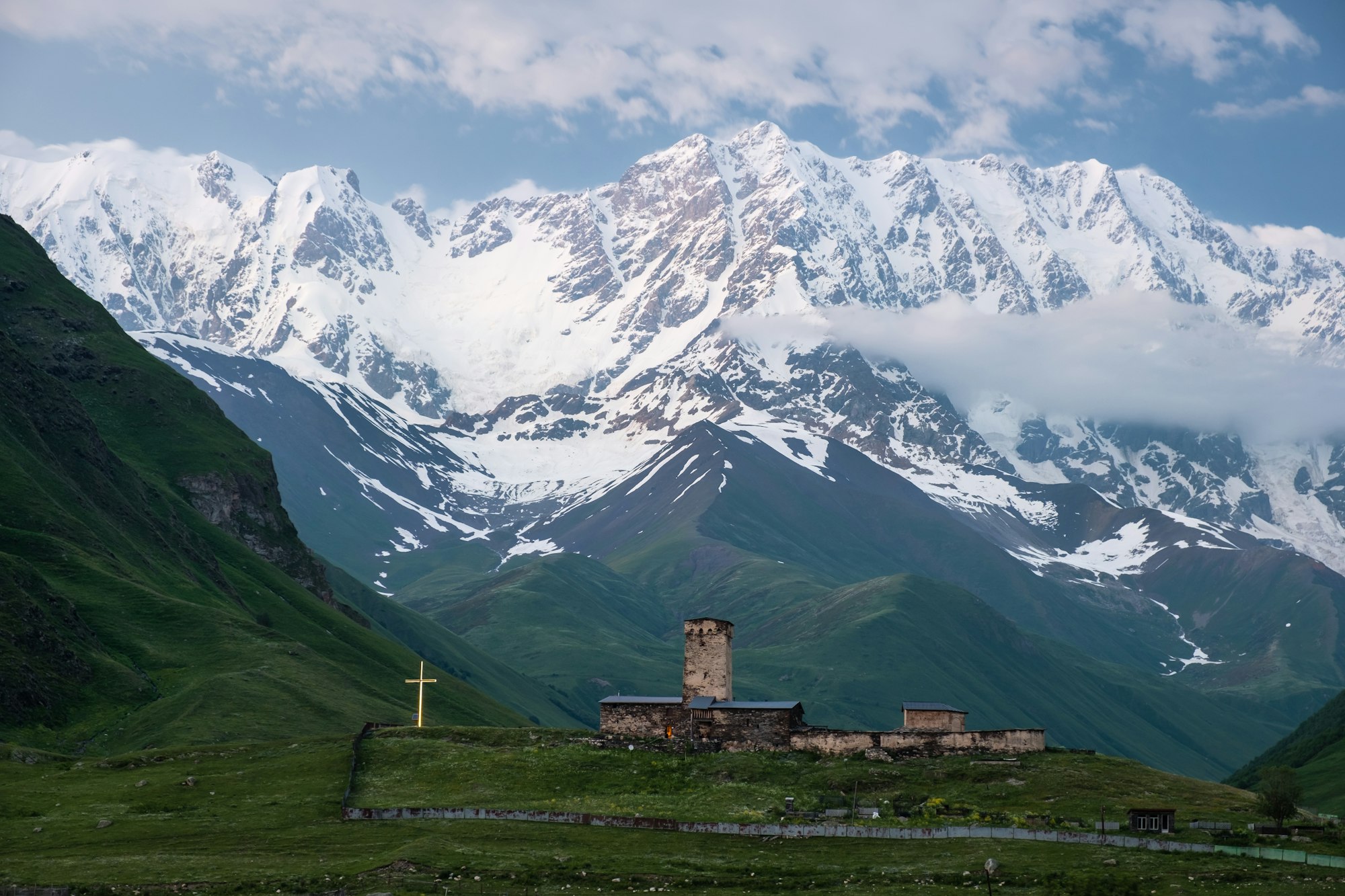
Kumano Kodo literally means "old ways to Kumano." It is a network of seven pilgrimage routes that converge on the Kumano Sanzan, the Three Grand Shrines of Kumano.

The Land of Gods
Back to when Kumano was not a sacred region. In prehistoric times, the area was revered as a sacred place where gods inhabited the natural landscape.
During the Heian Period (794-1185), the Kumano pilgrimage gained prominence when retired emperors and aristocrats began making the arduous 30 to 40-day journey from Kyoto to seek spiritual enlightenment in this remote mountain sanctuary.
By the 10th century, the pilgrimage routes were extensively developed, with the Nakahechi route becoming the preferred path for imperial travelers. The pilgrimage flourished during the medieval period, drawing people from all levels of society, including peasants, samurai, artists, and monks. This democratic accessibility was unusual for the time and reflected Kumano's reputation as a welcoming spiritual destination.
Along your route, you can witness the fusion of Shinto and Buddhism, two religions that coexisted here before being forced to disappear in the 19th century. This syncretic tradition is still visible throughout the pilgrimage, where Shinto shrines and Buddhist temples coexist within the same sacred precincts, and where natural features like waterfalls and ancient trees are venerated as divine.

Kumano Kodo Trail: 4 Paths Through the Sacred Mountains🏔️
Nakahechi: The Imperial Route🛕
The Nakahechi, known as the "Imperial Route," is the most popular and well-preserved path. It starts from Kii-Tanabe on the western coast and traverses eastward into the mountains toward the Kumano grand shrines. The route follows forested ridgelines and mountain valleys, featuring moss-covered stone paths, ancient cobblestone stairs, and traditional wooden shrines nestled among towering cedar forests. The highest point along the Ogumotori-goe section reaches 868 meters.
This Kumano Kodo trail route is approximately 75 km long, from Takijiri-oji to Nachi. The most popular section, from Takijiri-oji to Kumano Hongu Taisha, is 40 km; for many, this is sufficient and typically takes 2.5 to 3 days, with an overnight in Chikatsuyu or the Nonaka area. But for more experienced hikers, the full 75 km is a must. The complete route can be completed in 5 to 6 days with 4.5 days of active walking.
The Nakahechi is ideal for first-time Kumano visitors and those seeking a well-supported pilgrimage experience. It's suitable for moderately fit hikers who want a challenging but achievable mountain trek with good infrastructure. The route accommodates various fitness levels, as sections can be shortened using public transportation.
When to Visit and Best Experience 🎌
The route is open year-round, but optimal periods are:
- Spring (March-May): Comfortable temperatures, cherry blossoms, fresh green foliage.
- Autumn (October-November): Crisp weather, spectacular fall colors, ideal hiking conditions.
Avoid summer (July-August) due to extreme heat and humidity, and Japanese national holidays (especially Golden Week in early May and Obon in mid-August) when trails become crowded. Winter (December-February) brings occasional snow at higher elevations and shorter daylight hours but offers solitude and crisp mountain air.
Key highlights include🎐
- Takahara: The "Village in the Mist," perched on a ridgeline with panoramic mountain views and 800-year-old camphor trees.
- Chikatsuyu: A traditional village in a river valley, offering rest and refreshment.
- Yunomine Onsen: One of Japan's oldest hot springs (1,800+ years), including Tsuboyu, a UNESCO World Heritage bathing site.
- Kumano Hongu Taisha: The most important of the three grand shrines.
- Kumano Nachi Taisha: Final shrine complex featuring Japan's tallest waterfall (133 meters).

Kohechi: The Mountainous Route 🏔️
The Kohechi is the most challenging and remote route. This Kumano Kodo trail connects the Buddhist temple complex of Koyasan in the north with Kumano Hongu Taisha in the south. This rugged mountain path cuts through the Kii Peninsula's central highlands, crossing four mountain passes over 1,000 meters in elevation, including Obako Peak at 1,344 meters. The route zigzags up and down steep mountainsides, following high ridgelines through pristine forests with limited human presence.
The Kohechi spans approximately 70 kilometers and typically requires 4 to 5 days to complete. The route is divided into four main sections:
- Mizugamine Peak (Koyasan to Omata).
- Obako-toge Pass (Omata to Miura-guchi).
- Miura-toge Pass (Miura-guchi to Totsukawa Onsen).
- Hatenashi-toge Pass (Totsukawa Onsen to Hongu Taisha).
Each section takes about a full day, with overnight stops in valley settlements.
The Kohechi was historically used by Buddhist monks from Koyasan undertaking rigorous spiritual practices. Formulated in the 13th-14th centuries, it represents the shortest route connecting the two most important spiritual centers in the Kii Peninsula. Walking this path follows the tradition of Shugendo mountain asceticism, where the physical challenge itself serves as spiritual discipline.
Kumano Kodo Trail WARNING: Kohechi is exclusively for experienced mountain hikers in excellent physical condition. It requires previous multi-day hiking experience, good navigation skills, and the ability to handle isolation and challenging terrain.
When to Visit and Best Experience 🎌
The northern sections are officially closed from mid-December to mid-March due to snow at high passes. The southern Hatenashi-toge section remains open year-round. Best periods are:
- Late spring (May-June): After snow melts but before extreme summer heat.
- Early autumn (September-October): Comfortable temperatures and fall colors.
- The Kohechi experiences harsh weather, including heavy fog, rain, and wind.
Key features include🎐
- Koyasan: Sacred mountaintop Buddhist complex.
- Temple lodging: Opportunity to stay in Buddhist temples (shukubo) and experience traditional vegetarian monastery cuisine (shojin ryori).
- Hidden shrines: Moss-covered Buddhist statues and small wayside shrines.
- Dramatic vistas: Spectacular views from high passes across the Kii mountain ranges.

Ohechi: The Coastal Route 🌊
The Kumano Kodo Trail Ohechi follows the southwestern coast of the Kii Peninsula, offering a unique combination of mountain passes and oceanside paths. Unlike the inland routes, this trail provides expansive Pacific Ocean vistas from forested ridges before descending to sandy beaches and fishing villages.
The remaining preserved passes include Tonda-zaka, Hotoke-zaka, and Nagai-zaka, though much of the original coastal trail has been lost to modern road development.
Historically, the Ohechi connected Tanabe with Nachi Taisha over 100+ kilometers. Today's recommended hiking sections total approximately 40-50 kilometers, typically completed in 3 to 4 days.
Many hikers tackle individual passes as day trips rather than through-hiking the entire route. The modern trail generally ends at Mirozu Station, as sections beyond have been paved over by highways.
The Ohechi is ideal for hikers who want moderate coastal walking with ocean views and easier logistics. It suits those with limited time who prefer day hikes over multi-day mountain treks.
The route is more accessible than mountain routes, with regular train service and more accommodation options. It's perfect for travelers who want to combine hiking with beach relaxation and hot spring towns.
When to Visit and Best Experience 🎌
The coastal climate is milder than the inland mountains:
- Spring (March-May): Pleasant temperatures, comfortable hiking.
- Autumn (September-November): Best weather, clearer ocean views.
- Winter (December-February): Mild but can be windy; photographers favor winter sunrise fog.
For this Kumano Kodo trail, the summer can be hot and humid, but it offers swimming opportunities.
Diverse scenery and cultural experiences🏮
- Tonda-zaka slope: First major coastal pass with forest trails and ocean views.
- Agonowatashi Ferry: Traditional river crossing, currently the only operational ferry on the route.
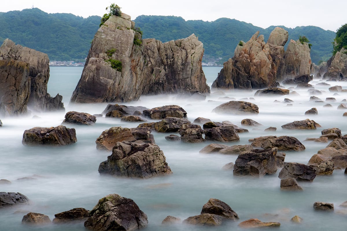
- Senjojiki: Dramatic wave-carved cliff formations.
- Coastal villages: Traditional fishing communities maintaining centuries-old ways of life.
Iseji: The Eastern Route 🗾
The Iseji follows the eastern edge of the Kii Peninsula, stretching from Ise Grand Shrine to the Kumano Sanzan. This route traverses dramatically varied terrain, like fertile river plains, mountain passes, bamboo forests, terraced rice paddies, and long coastal stretches.
The Iseji spans approximately 170 kilometers, making it -by far- the longest Kumano Kodo trail route. The traditional pilgrimage takes two weeks, though most modern hikers select specific sections. The route divides into three sections:
- Northern section (70 km): Ise to mountain passes, mostly flat on paved roads.
- Central section (75 km): Mountain passes connecting coastal villages, the core UNESCO World Heritage area.
- Southern section: Final approaches to Kumano Sanzan.
The Iseji rose to prominence during the Edo period (1603-1868) as the number of pilgrims visiting Ise-jingu Shrine increased dramatically.
The traditional practice was to first visit Ise (Japan's most sacred site), then continue to Kumano, wearing white burial robes symbolizing spiritual rebirth.
This "Ise-Kumano" pilgrimage combined Japan's two most important spiritual destinations.
- The extensive cobblestone construction demonstrates the route's historical importance,
- And the engineering efforts made to maintain it.
The Iseji is perfect for adventurous, experienced hikers seeking an authentic, uncrowded pilgrimage experience. It suits those who want to see rural Japan rarely visited by tourists. The combined coastal and mountain scenery, and walking the original cobblestone paths, requires more independence and Japanese language skills.
When to Visit and Best Experience 🎌
The route is accessible year-round with Mie Prefecture's mild coastal climate:
- Spring (April-May): Cherry blossoms, comfortable temperatures.
- Autumn (September-November): Fall colors, ideal hiking weather.
- Summer: Hot and humid with the highest mosquito activity.
- Winter: Crisp and clear, fewest crowds.
Unlike Nakahechi, the Iseji lacks centralized booking systems. Plan accommodations independently using Mie Prefecture tourism resources. Many sections can be hiked as day trips from coastal towns.

I'm so glad you made it this far. Plan V is an independent magazine, and your donation allows me to continue doing this.
See you soon.
Thank you!
FAQS
How long does it take to walk the Kumano Kodo?
The answer depends entirely on which route you choose and how you pace yourself.
- The Nakahechi, the most popular route, takes between 2.5 and 3 days. If you focus on the classic section from Takijiri to Hongu, or 5 to 6 days if you walk the full trail all the way to Nachi Taisha.
- The Kohechi requires 4 to 5 days due to its mountainous terrain.
- Ohechi can be completed in 3 to 4 days, though many hikers prefer to tackle it in shorter day-trip sections.
- The Iseji is the longest route at around 170 kilometers, traditionally taking about 2 weeks in its entirety.
Is the Kumano Kodo trail hard?
The Kumano Kodo offers a wide spectrum of difficulty, so it depends on which route you take. The Nakahechi is the most accessible option, featuring well-maintained paths, clear signage, and regular stops in villages with accommodations and food.
Where does the Kumano Kodo trail start and end?
Each route has its own starting and ending points, but they all converge on the Kumano Sanzan, the Three Grand Shrines of Kumano. The Nakahechi begins in Kii-Tanabe on the western coast, with the UNESCO-designated section starting at Takijiri-oji, and ends at Kumano Nachi Taisha. The Kohechi starts at the sacred Buddhist complex of Koyasan in the north and ends at Kumano Hongu Taisha in the south. The Ohechi follows the southwestern coast from Tanabe toward Nachi Taisha, though many preserved sections end at Mirozu Station due to modern road development. The Iseji is the only route that begins outside the Kii Peninsula's core, starting at the Ise Grand Shrine in Mie Prefecture before heading south to reach the Kumano Sanzan. No matter which path you choose, the journey always leads to one of Japan's most sacred spiritual destinations.
Can you walk the Kumano Kodo by yourself?
Absolutely. Solo hiking is very common on the Kumano Kodo and the infrastructure supports it well, especially on the Nakahechi. The trail is well-marked with English signage, and services like Kumano Travel allow you to independently book accommodations, luggage shuttles, and meals with ease.